The River A’an (Avon) is the largest tributary the Spey and is normally a highly significant producer of smolts. It is a diverse and productive river in its own right although it begins as an extremely low nutrient river with its source in the midst of the granite Cairngorms. Upstream of, and in the vicinity of Inchrory Lodge, the water chemisty benefits from several productive tributaries such as the Allt Loin Bheag and the Allt Loin. In and around the confluences of these tributaries localised pockets of higher fish productivity can be found.
In 2016 the juvenile stock was low, the fry year class of that year in particular was almost missing, this due to the effects of Storm Frank and subsequent high flows. Given the importance of the A’an we repeated some, or all, of the timed surveys in 2017 and 2018.
The blog provides an update on our findings in 2018.
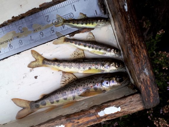
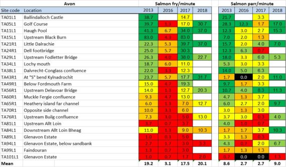
In the A’an, from about site TA43, which is just below Tomintoul, upstream, the presence of multiple year classes of parr becomes a prominent feature of the salmon population.
These results were encouraging, the A’an can be expected to be producing good smolt numbers again from next year. The Fishery Board is also seeking to introduce enhanced predation control measures in tributaries such as the A’an, which will only help.
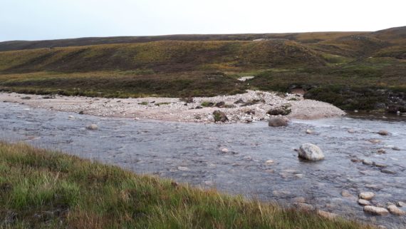
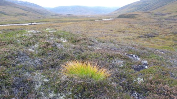
A few more points of interest noted.
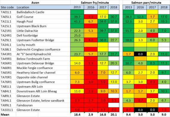
As requested here is the Avon mainstem table as shown above but this time with all the figures.






5 thoughts on “A’an surveys 2018”
Informative and encouraging. Thank you for the work and the report.
Brian
Thanks for the update and pics of the A’an.
I have been fishing the middle stretch on a regular basis this year and have been surprised at the amount of water coming down the river despite the near zero rain fall over the period and the early clearance of hill snow.
In these times is the primary source of water from springs – if not where is it coming from
Kind regards
Kevin James
Hi Kevin, When we were surveying in the middle reaches (above Delnabo) we thought the Avon was low, as low as we had seen it, although the following week the flow in the upper reaches was bank to bank. The Cairngorms have been catching some rain recently which would explain that situation. I had a good chat with a farmer in the upper Livet this week, he was commenting that it was only in the last week or two that the water levels had dropped in that part of the catchment. We had previously noted how stable the burns in the Glenlivet area were; they obviously receive a lot of spring water. The geology of the Cairngorms is quite different to Glenlivet, different hydrology too, I suppose?
Cheers Brian
Hi Brian, would it be possible to reproduce the colour coded graph above with the actual figures included. Just out of interest.
Thanks, Euan.
Added to bottom of post, as requested.
Cheers Brian